About Manuscript Maps

Thanks so much for visiting. My name is Kevin - I'm the cartographer here at Manuscript Maps.

I started Manuscript Maps back in 2014 after I finished my PhD. It started as a small hobby business and way to make a bit of extra money. As of November 2022, drawing and selling my maps is my full-time occupation!

All of my maps are drawn by hand. I use traditional drafting techniques employing dip-pens with calligraphy and drawing nibs. Each original takes weeks or even months to produce. Sure, I could create maps faster using a computer, but I truly believe that the end result looks so much better and more authentic by carefully scribing every letter and drawing every line by hand.

I sell signed edition prints of my cartographic creations, plus a few other products printed with my maps. I also accept commissions for originals.


Inspiration

Maps are commonplace in today's world, yet many are hastily made on computers with concern only for basic function. So many maps ignore aesthetics, form, and good design. Combining my love of maps and my experience as an artist, my mission is to bring art back to cartography.

I am greatly inspired by antique maps from centuries ago, when map-makers were also great artists. Often working alone, or in small workshops, master cartographers created beautiful maps that served both aesthetic and practical functions. I studied the height of map-making culture (AD 1200 to 1700) in my PhD, which was awarded by Durham University in 2014. Energised by my historical research, I have set out to create maps using methods employed by map-makers over the centuries. I even draw some of my maps on real calf-skin vellum, just as medieval cartographers would have.

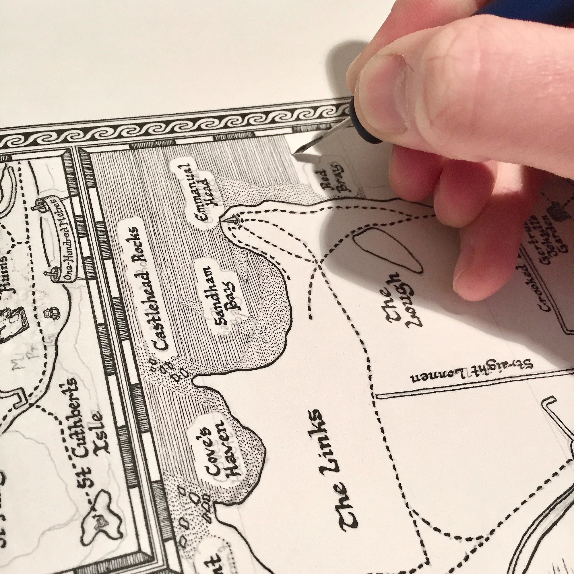
This time-lapse video shows how I draw my maps: detailed planning in pencil, then drawing in pen. This particular map of the island of Lindisfarne took two months to make from start to finish; just the shading of the sea took over three hours! But the result was definitely worth the time.

Find out more about my map-making process in my blog series.

Current & Future Projects

My most recent creation is a map of Viking Britain, which took four months to draw. New editions of popular maps continue - Durham University and the Whisky Map, which is now on its 11th edition! I’m also planning a second edition of the Moon Map, which is the largest and most detailed map I have ever drawn.

Sketch Plan for the Ireland Whiskey Map

Coming up is a map of the Whiskey Distilleries of Ireland, Firenze (Florence Italy), and Ports of Portugal.

Cambridge University will be coming up too quite soon. Future plans include heritage railways of England, wine regions of the world, theatres of London, a rum map of the Caribbean, a cheese map of Europe, and maps of York, Oxford, Edinburgh, and Newcastle. If you have any suggestions for future maps, please get in touch!

For exclusive discounts, and to get the latest information on new maps for sale, please follow Manuscript Maps on Facebook, InstagramTwitter, or subscribe below.